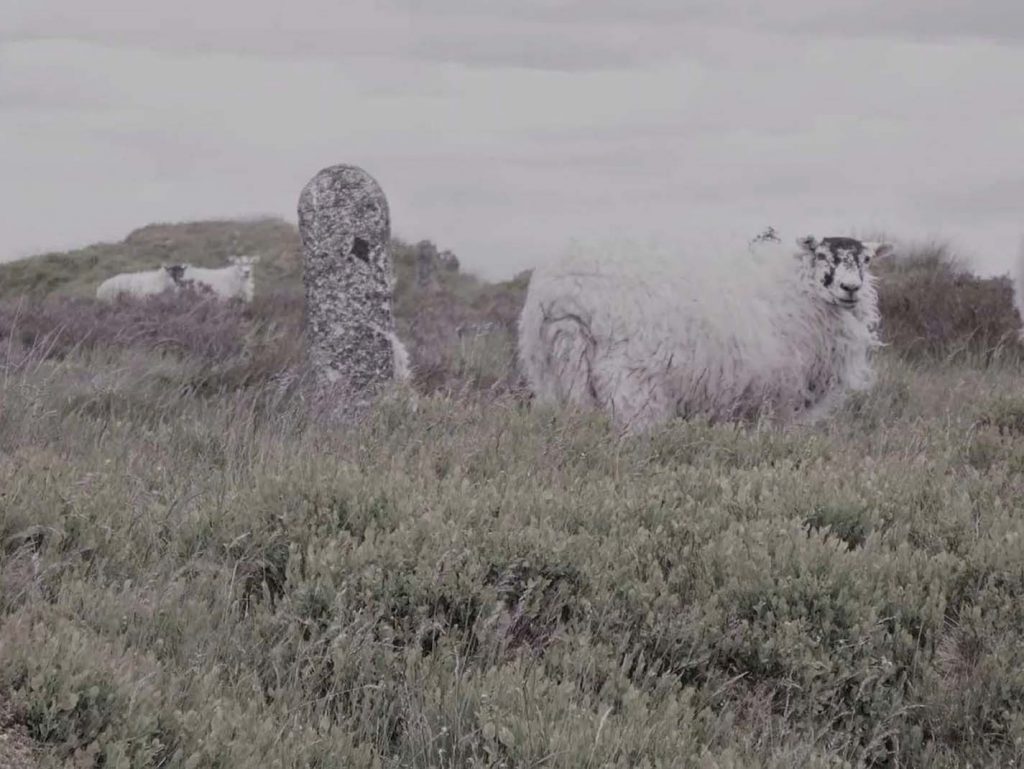
Kate Green “Watershed Line” Credit: https://www.shortladywithdarkhair.com/watershed-line
As part of the release of my book, Walking as Artistic Practice (pre-orders now open for softcover shipping in April!), I’m going to be publishing some brief interviews with the various artists, authors, researchers, creatives, collectives, and platforms whose art practice, written material, or other works I cite and mention.
My 20th interview in this series is with Kate Green who wanders and wonders (mostly in the Welsh Borders) presenting thoughts on life and landscape with her unique blend of humour, song and gentle satire. Kate’s work is usually springboarded by a walk but is also formed by research, archaeology, geology, social history
and serendipitous conversations.
EM: First, thank you for chatting with me about your work Watershed Line (2021). I cite this work in chapter seven (Place) in the subsection on “Urban versus Rural” How would you describe the work for people who might not be familiar with it?
KG: In 1892, an Act of Parliament allowed the City of Birmingham to claim the gathering grounds, or watershed, of the Elan and Claerwen rivers in Mid Wales. A massive engineering scheme involving thousands of construction workers (navvies) built a series of dams to capture the water and pipe it to Birmingham. The Elan Valley reservoirs still provide the majority of Birmingham’s fresh water.
For Walking the Pipe (2019) I walked the 73 ½ mile aqueduct that caries water from the Elan Valley reservoirs to Birmingham. In Watershed Line (2021) I walked the perimeter of the 72 square mile watershed of the Elan and Claerwen rivers. Mapped and termed the ‘Watershed Line’ by the Victorian engineers surveying the site prior to flooding, this tipping point in the water’s flow is marked with hundreds of concrete posts – some now fallen, sunk into bog, shattered by frost, or hidden by vegetation. On my walk (over 2 weeks) I photographed each of the 540 concrete posts I encountered. During the evenings, staying alone in an off-grid cottage, I recorded my experiences in a journal and composed four songs inspired by my walking, reading and research.
After my residency in the Elan Valley, I became involved in trying to kickstart the renovation of a scale model of the reservoirs in a Birmingham Park. Although this wasn’t successful (yet!) it led to the opportunity to curate the Watershed exhibition, showcasing the Elan Valley artist residency scheme with archives and artefacts. I was also commissioned to create a new interpretation of my concrete post images: a 10m wide, 3m high mural of the images, with their perspective manipulated to face the viewer with a convex dam-like wall.
Watershed at Midlands Arts Centre (June-November 5th 2023) plays on the dual meaning of the term ‘watershed’ – ‘an area of high ground where rain collects, bounded peripherally by a dividing ridge, draining into a particular river or body of water’ but also ‘a significant event or period that represents a change in direction, or tipping point, in how people think about something’. Its climatic message was inspired by Antonio Guterres’ speech at COP27 in 2022: “… our planet is fast approaching tipping points that will make climate chaos irreversible. We are on a highway to climate hell with our foot on the accelerator.”
EM: What are your thoughts on walking as artistic practice?
KG: Goodness that’s a big question. I’m not sure I can answer in one sitting. But I would say that I am not an artist for whom only the walk is the work. For me, the walk is part of the work. It may be that a piece of research or a story leads to a walk, or a walk inspires a creative response – be it song, sculpture, drawing, a gathering or happening maybe. But a walk is always there somewhere in the creative journey, and the other forms within the work could not exist without the walk.
EM: Can you tell us about any recent or upcoming projects you are excited about?
KG: I am currently resident artist at the Sidney Nolan Trust. Inspired by research into Nolan’s 1964 trip to Antarctica, I am working on a project about Glacial Lake Wigmore, a lake that filled a North Herefordshire valley (right on my doorstep, so far easier to reach than Antarctica!) 20,000 years ago. Geological research suggests that the highest water level reached is indicated on the modern OS map by the 130m contour line. Due to the erosion of a gorge and centuries of agricultural drainage, only a few marshy areas now remain. I have been walking the once-shoreline, beachcombing stories: geographical, archaeological and personal. The shape of the lake has become a motif in my drawings and I’m in the process of composing and arranging new songs in response to my own journey of exploration in the ice.