Ellen Mueller

Interview with Esther Polak

by Ellen Mueller on February 5, 2024, no comments

a black and white map of Amsterdam

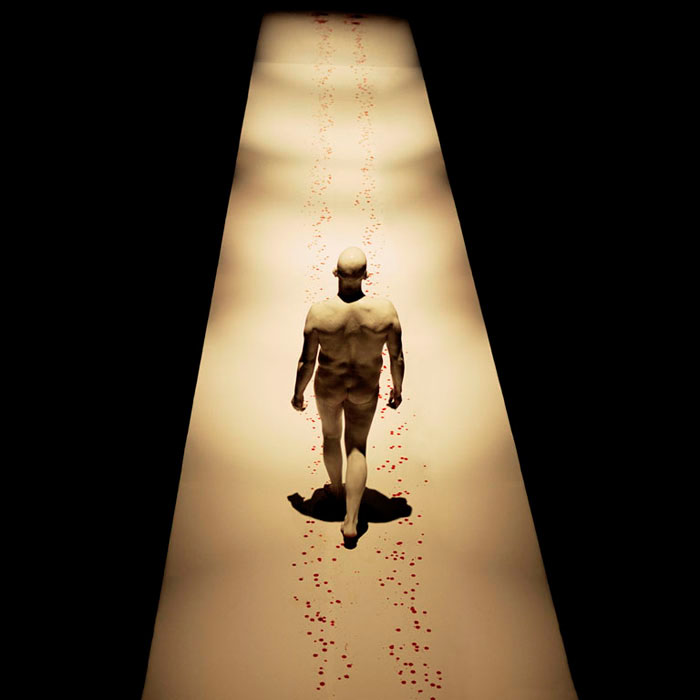
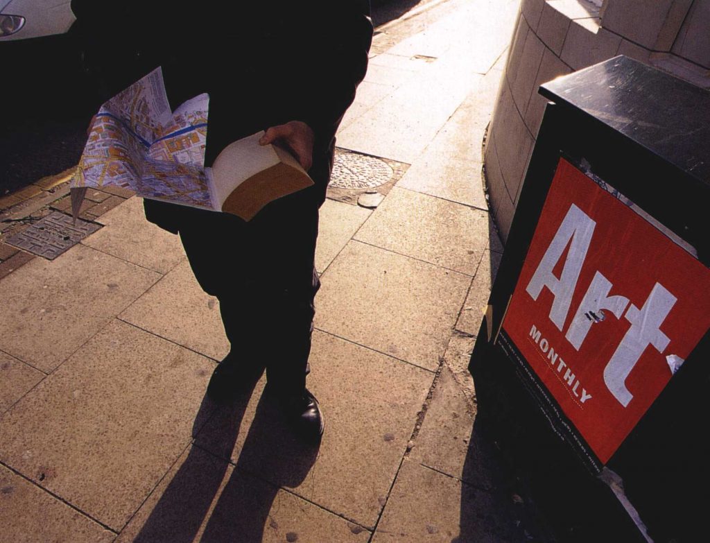
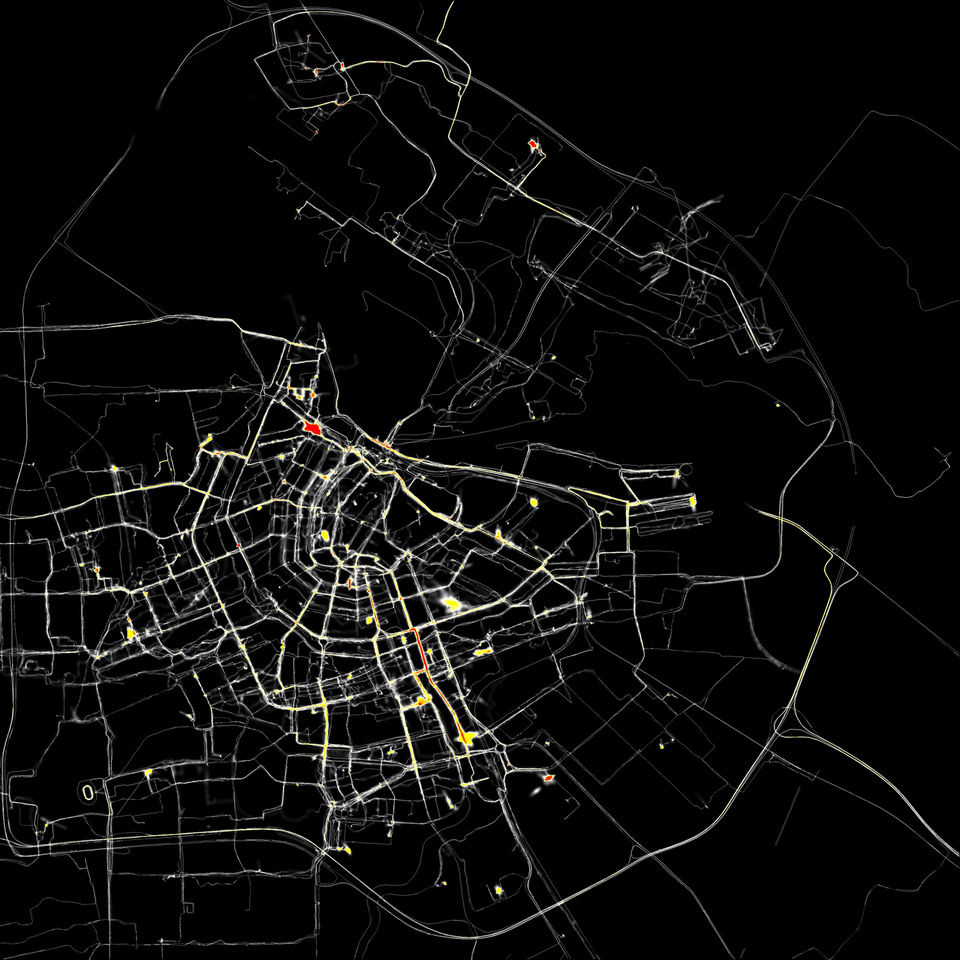
“AmstedamRealtime” digital print (2002)

As part of the release of my book, Walking as Artistic Practice (pre-orders now open for softcover shipping in April!), I’m going to be publishing some brief interviews with the various artists, authors, researchers, creatives, collectives, and platforms whose art practice, written material, or other works I cite and mention.

My 25th interview in this series is with Esther Polak who explores choreographies of daily life: walking, cycling, driving, flying, and wandering. In their view, the drive to move creates a world or space rather than taking place in an already existing one. Rooted in the Dutch realistic landscape depiction history, they express personal experiences of moving and space. Collaborations with participants often inform their projects, be it humans, animals, or even the rays of the sun. PolakVanBekkum is/are supported by the Mondriaan Fund and Dutch Film Fund. Their work is part of private and public collections and has been show at exhibitions and (film)festivals.

EM: First, thank you for chatting with me about your collaborative work, AmsterdamREALTIME (2002, with Jeroen Kee and Waag Society). This piece is mentioned in  Walking as Artistic Practice chapter nine, “Connections to Drawing,” in the subsection on “Technology and Mapping,” because this work involves GPS to create visualizations. How would you describe this work for people who might not be familiar with it?

EP: I think the first thing that is really important for this work is that it was made in 2002, and that was really a year after the use of GPS technology was even given free for civilian use. Because first it was only developed as a military tool, and that change was the backdrop of this project. So the public, most people, had no experience with GPS at all, let alone with being able to record their own trajectories and see them. Of course, there was a long tradition of maps, but they were always made at a totally different moment than the moment that the walk or whatever move actually took place.

And the interesting thing about GPS was that you could move around in the world, for example, walking and drawing your map or at least your trajectory, at the same time. And that was what is very important for this work. I sometimes compare it with the first photography – the first photographs made a total new way of relating space to visual memory possible. And I think the emergence of GPS technology also makes a total new relation to space and the concept of memory possible. And that was what fascinated – fascinates me still – about this project.

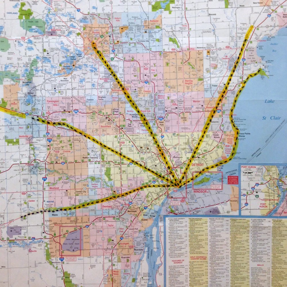
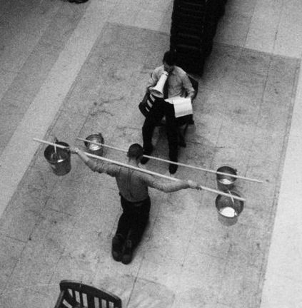
To describe it, the idea was to realize the possibility for Amsterdam citizens to record their own movements in the city and to in real time visualize that in an exhibition space. And that was really innovative at the time. So we invited the project to last for six weeks, and we then were able to develop, I think 10 drawing devices. And that was really innovative because it combined the GPS information with a method of connecting with exhibition space in real time. So now we are very used to mobile phones that can both – that can directly show your location through wifi or through your cell connection to another person and even your trajectory. But back then there was something totally new.

So the audience entered that exhibition space and they saw a huge black screen with little white lines emerging. And when they were moving, you were, you knew that that was a person that was going about there at that very moment. That’s also why it was called AmsterdamREALTIME. And Amsterdam was a very nice city too, it was the city I was born in, so it was, it’s my city. It was a very nice city to develop this project because it has such a very distinct circular map. So it has a very interesting, almost like a fingerprint layout. So that was really, for me, it was really groundbreaking.

computer generated image of teal orbs and the words move act floating in space

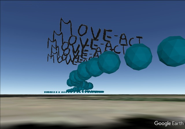
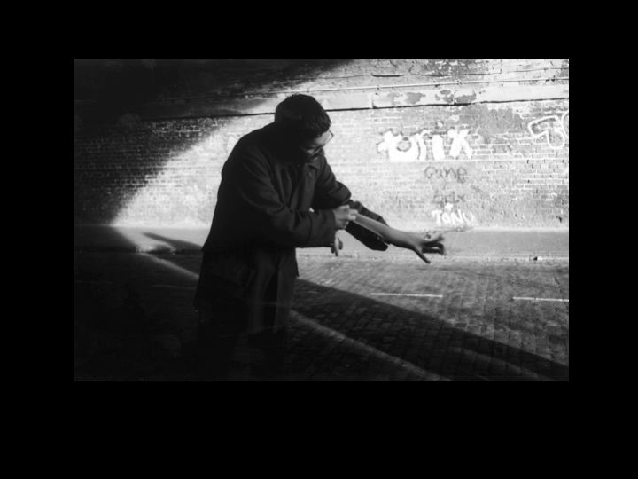
The City as Performative Object 2017 (Move-Act) filmstill

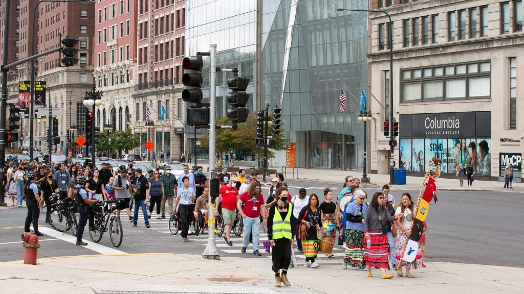
EM: What are your thoughts on walking as artistic practice beyond AmsterdamREALTIME?

EP: AmsterdamREALTIME was really a sort of key work for me, and from it, I developed a whole method of thinking about mobility in general. So for me, the interesting thing about human walking is that humans not only walk – walking is only one category of mobility that we employ. So we also, especially in Amsterdam, many of the participants in AmsterdamREALTIME went by bike because that is the most, especially 20 years ago, but still the most normal way of going about in the city for the people who actually live there.

I started to be really interested because we had participants that were pedestrians that that went by bike, and that then went by automobile, which is very inconvenient in Amsterdam. I started to be really interested in these different categories of mobility possibilities. And I called it Move Act.

I was also interested in Judith Butler, who developed a whole theory on the categorization between genders, male and female. And I appropriated that to mobility. And I developed a whole line of thinking about mobility patterns and landscape depending on which me, which move, act category, move category you find yourself in. And that’s interesting.

For example, now we’re in my little studio in the east of the Netherlands, and that is at the border of one of our rivers, the isle. And because of lots of rain, the water is really high. So I’m going to show you what I’m see from my window. So instead of living alongside a river, it looks more like I live alongside a lake, but as you can see, trees there are halfway in the water. So in other seasons, I can go there and just walk in the flood lands, but now they are all flooded, as flood lands, the name says. But now you can only enter them, for example, with a little boat or canoe. And now I sometimes see people passing in their canoes. I realize that depending on your means of transportation, you are in a totally different landscape. So now the landscape actually totally changed because of the water. But, if you go through the same landscape one day, you go walking the next day, you go by bike, and another time you go by car, it is a different landscape than it is even as if the landscape really totally changes its identity.

Um, so instead of thinking of landscape as a given that you as a mobile entity decide to move through, I prefer to think of it as something that you produce by moving. So, I think when you choose walking as an artistic practice, then you decide for a specific means of transportation, and that will also determine the kind of landscape that you produce on the goal. I think, I hope, I can imagine that other artists who use that can feel, can recognize that, feel, that approach, but I think that the different means of transportation really make me aware of how productive it is to be mobile.

a blue drawing of abstract lines on white paper

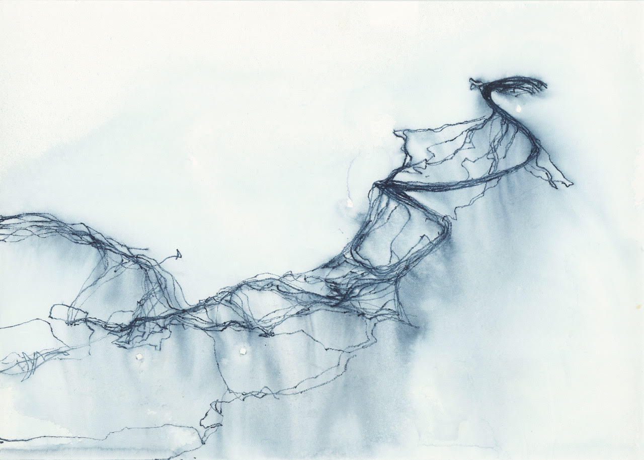
“Grazing Choreographies” 2019 drawing on paper

EM: Online biographies mention your interest in telling human stories. Can you discuss how another of your projects, NomadicMILK, does this with a focus on nomadic herdsmen in Nigeria?

EP: Your third question is about my interest in telling human stories, and the project I did in Nigeria with nomadic herdsmen. And, I feel more inspired to tell something about what was the start of that project. That was my fascination for grazing. Grazing is a very, for me, super fascinating act, but that is not really a human act, but more an act by animals because we humans, we don’t graze, we herd animals that graze. So maybe the animals graze for us and that makes us also a grazing species. I don’t know. But the grazing is super interesting because in the Netherlands you have an enormous culture of cow breeding, especially for milk protection. And I was very interested how that produces a specific kind of landscape, both from the human and from the animal perspective, I think.

The meadow as such can be seen like as an empty piece of paper where nothing has happened yet. But as soon as the meadow is being grazed, it is produced because if you leave a meadow without grazing in a couple of years time, it will become, it’ll become a forest because little plants will grow there, the more plants will grow there and nothing grazes it. And then in the end stage of the ecosystem will be a forest. So the meadow is always a landscape that is produced by grazing, and I was really interested in the mobility patterns that the grazing would bring about.

And in total, me and Eva, we are an artist couple, we did in total three different projects on grazing. The first project was, a project where we followed one dairy line from Latvia to the Netherlands. And that was more about the human stories, about how people were interacting with this chain of milk and how all participants in the milk chain describe their lives after a GPS recording we made with them.

And then I started to be really interested in that on a more global scale, and also on how milk production is globalized. And in Nigeria, for example, the milk production is both, depending on the nomadic milk herdsmen, who herd their cows in Nigeria, but also very much on international multinationals, and especially one Dutch one. So we followed not only the nomadic herdsmen, but also the people involved in the multinational milk production of powder milk in Nigeria because that turned out to be two total different projects.

And the third project on grazing that we did was super much more basic and simple, but also came with human stories. We decided to try to leave all technology behind and use our experience with GPS to develop a new method of drawing. So what we did was we were sitting next to a meadow and we started to draw the grazing patterns of the cows that are in the meadow. So we really took the time to observe them, to be a kind of a human GPS, be very patient and attentive to the cows, how they move. And we made drawings out of that. And we also wrote down our experiences during those observations. And that resulted in a book that is called Grazing Choreographies.

And in the coming spring, that’s why I really like to tell you about it. The coming spring, we are invited to an artist residency also here in the east of Netherlands, not very far from here, 20 kilometers further up east to develop these drawing methods further. And we are going to make the drawings now in a bigger scale. Also I want to be more connected to the farmers that we work with, so that also their perspective will be part of the project, which was not the case in the book that we already published.

So for me, walking is a very, is always contextualized, is one of the many possibilities of being in move-act. Also it is not limited to humans. I’m also super interested in, for example, grazing animals for now, but I can also imagine that that could be different animals or even machines. And especially my focus is on how those mobility move-acts, how they produce landscape instead of taking place in an already existing landscape.

Interview with Franko B

by Ellen Mueller on January 29, 2024, no comments

nude man walking down a runway with blood spots

Franko B, “I Miss You” (1999-2005), performance still. Photo Credit: Manuel Vason

As part of the release of my book, Walking as Artistic Practice (pre-orders now open for softcover shipping in April!), I’m going to be publishing some brief interviews with the various artists, authors, researchers, creatives, collectives, and platforms whose art practice, written material, or other works I cite and mention.

My 24th interview in this series is with Franko B (born in Milan in 1960), who is an Italian visual artist based in London, where he has lived since 1979. He studied fine art at Camberwell College of Arts (1986–87), Chelsea College of Art (1987–90) and the Byam Shaw School of Art (1990–91). Includes performance  video, photography, painting, installation, sculpture and Djing.

EM: First, thank you for chatting with me about your work I Miss You (1999-2005). I cite this work in chapter nine (Connections to Drawing) in the subsection on “Performance Links.” How would you describe the work for people who might not be familiar with it?

FB: visual art

EM: What are your thoughts on walking as artistic practice?

FB: we are always walking  i like walking . as an. artist practice ?. i love art , if it move me it can be what it need s or want to be .i do what is necessary to the image i’m trying to making

EM: Can you tell us about any recent or upcoming projects you are excited about? 

FB: life

Interview with JeeYeun Lee

by Ellen Mueller on January 22, 2024, no comments

a map of Detroit with five lines highlighted across it

JeeYeun Lee, “Walking Detroit” (2017-18) (map)

As part of the release of my book, Walking as Artistic Practice (pre-orders now open for softcover shipping in April!), I’m going to be publishing some brief interviews with the various artists, authors, researchers, creatives, collectives, and platforms whose art practice, written material, or other works I cite and mention.

My 23rd interview in this series is with JeeYeun Lee, an interdisciplinary artist based in Chicago. After quitting a PhD program in her twenties, she worked as a full-time nonprofit worker for over twenty years, and then quit that to focus on art-making. Now she deploys her academic and nonprofit skills in her art projects, using various topics and mediums to see if art can enable liberation.

EM: First, thank you for chatting with me about your work Walking Detroit (2017-18). I cite this work in chapter two (Analyzing Walking Works) in the subsection on “Written Texts,” and in chapter five (Who Gets to Walk and Where?) in the subsection on “Race.”  How would you describe the work and its accompanying book for people who might not be familiar with it?

JYL: I went to the Detroit metro region in 2016 to start an MFA program at Cranbrook Art Academy. It was a discombobulating place and environment. Someone told me that the radial roads in the Detroit area were built on trails that Native people had used, and immediately I thought of walking them. I moved around a lot as a child, and walking had always been a way of orienting myself. I hadn’t known that artists used walking as a practice before I started this project. I walked five radial roads for 25 miles each, and also walked the borders of three different suburbs. Walking was a way to both research and witness the structures of racism, colonization, and capitalism as they have shaped the region. I edited my thesis book from the MFA program into a self-published book documenting this project, with writing and photos from each walk.

The book also includes a few related projects, including my MFA thesis piece. For that project, I decided to focus on the Cranbrook campus, which is celebrated for its place in the mid-century Arts and Crafts movement in the U.S. I created an hour-long audio walk around the 300-acre property that narrates excerpts from my research on the construction of the Cranbrook campus, the white settler history of that region, settler colonialism in general, and Indigenous perspectives on land. I hadn’t thought much about settler colonialism before coming to Detroit, but focusing on place pretty much forces you to look at it. This is when I began really thinking about my position as someone occupying Native land, and what I wanted to do about that.

The book basically is my personal compendium of all the learning and thinking I was doing about Detroit at the time. The appendices in the book include a bibliography of Detroit, and slides from a talk I gave about the history of racism and colonization in the Detroit area. These were all partial in every sense of the word, since there could be no way to include everything.

EM: What are your thoughts on walking as artistic practice?

JYL: It’s a contradictory position. I like that we’re in an era when walking (and almost anything) can be considered as part of an artistic practice. So you can be an artist and say that your artwork is based on walking, and while most regular people will require a lot of explanation (and doubt that you’re really an artist), the people who like to push the boundaries of what’s considered art will feel like they are hip to include your work in that definition. At the same time, I’m glad that walking is such a mundane activity that it still degrades that definition of art, and as a time-based performative medium, walking doesn’t really create anything that can be put on the art pedestal. I enjoy those contradictions.

A crowd walking down a Chicago sidewalk

JeeYeun Lee “Whose Lakefront” (2021); Photo by Peter Fitzpatrick

EM: Can you tell us about any recent or upcoming projects you are excited about?

JYL: My two most recent projects involve the Chicago lakefront. When I came back to Chicago after the MFA program, I wanted to learn more about this city that I had grown up in. I was inspired by a book by Potawatomi historian John Low called Imprints: The Pokagon Band of Potawatomi Indians and the City of Chicago. In it, he describes a lawsuit that his tribe filed against the city of Chicago in the early 1900s for the land along the lakefront. The tribe said that in the treaties they had signed ceding land in Illinois, the eastern border was the shoreline of Lake Michigan. Since then, the city had created land along the shore with landfill, extending beyond that border. So the Potawatomi sued to get that land back, or have the city pay them for it. The case went all the way up to the U.S. Supreme Court, which of course ruled against the Potawatomi.

I had never learned about this case, and never thought about any contemporary claims that Native people might have in Chicago or Illinois. So I worked with Professor Low and a committee of Pokagon Potawatomi and other Native artists and community members to produce Whose Lakefront. This was a procession in downtown Chicago where we drew a line of red sand along the sidewalk of Michigan Avenue, the border of the landfill, to mark the presence of unceded Native territory. This was the biggest project I’d done up to that point, with over 120 people in the procession, 40 volunteers, 1,600 pounds of red sand, and tons of bureaucracy.

Doing the research for that project got me fascinated with the actual construction of the landfill, so I just wrapped up Shore Land, which is an audio walk. Everyone loves the lakefront because it’s public access green space, but it’s such a contradictory place because the Burnham plan, which inspired much of Chicago’s park system, was created to suppress working class discontent, and, as I said, the lakefront is also unceded Native land. The audio narrative looks at this contradiction, with excerpts from the treaties, lawsuits, legislation and planning documents that have created the landfill. I wanted to focus on the languages that have made this settler engineering possible. But it couldn’t just be the settler side, so I also included excerpts from interviews I did with Native environmentalists and artists who talk about Indigenous perspectives on the sovereignty of land and water. I’ve released all the audio segments, and I’m going to work with the Chicago Park District to see if they’ll let me put signage along the lakefront so people can access and listen to the audio segments as they walk.

Interview with Tim Brennan

by Ellen Mueller on January 15, 2024, no comments

a person with a map and book on a street with an Art Monthly box in the foregound

Tim Brennan, ‘Reading Capital’ manoeuvre, ‘You Are Here’, Holden Gallery, Manchester (UK), 2000. Photo Credit: Gary Kirkham.

As part of the release of my book, Walking as Artistic Practice (pre-orders now open for softcover shipping in April!), I’m going to be publishing some brief interviews with the various artists, authors, researchers, creatives, collectives, and platforms whose art practice, written material, or other works I cite and mention.

My 22nd interview in this series is with Tim Brennan, an English artist active since the 1980’s. His work is not limited to one mode of production and includes the visual and sonic. Performance and the performative are consistent threads in his international practice.

EM: First, thank you for chatting with me about your project Vedute Manoeuvre (2011). I cite this project in chapter three (Observational Walking) in the subsection on “Sight,” mentioning the use of “view cards.” How would you describe this project for people who might not be familiar with it?

TB: I made Vedute Manoeuvre for the 54th Venice Biennale in 2011 (Gervasuti Foundation exhibition: The Knowledge curated by James Putnam and Eiko Honda). I wanted to make a work that could be engaged with at any time in Venice and one that wasn’t limited to the Biennale timeframe and so I made a guided walk that focuses on the iconic Piazza San Marco (St. Mark’s Square). I gained the rights to reproduce a series of Canelletto depictions of the Piazza as A4 cards. There are 14 cards in total. On the reverse of each card, I described the directions a walker should take and where they should stop to read a quotation that followed on. The quotations were drawn from a range of sources, including a description of the Futurist Manifesto and its launch from the top of the Campanile (belltower) in the early 20th Century, to an extract from John Ruskin’s Stones of Venice in which he advocates using cheese as a sculpting material with which to create/recreate architectural models.

The word ‘vedute’ in the title translates from the Italian into English as ‘views’. Canelletto as a ‘veduta’ – a painter of views. I wanted to create a work that revealed the multiplicity and complexity of the word. I chose Canaletto’s paintings as, at first glance they appear to give a pre-photographic sense of realism to the journey. The idea being that walker can use each painting to locate themselves quite specifically in the location by marrying up an image with a view observed in person in the Piazza. When you use the cards, it is then revealed that Caneletto made artistic decisions, moving objects and adding and subtracting aspects to arrive at the best formal arrangement on a canvas.

The collision of quotations with each other and aspects of the Piazza observed prompt the walker to think and consider themes, topics, contexts and their own position in time and space. Along the bottom of each card runs a critical essay by writer Dr. Heather Yeung.

a man kneeling with buckets on a stick on his shoulders and a seated man reading to him through a megaphone

Tim Brennan, ‘Impasse’ performance with David Coxon, ‘Artists and War’, Ferens Art Gallery, Hull (UK), 1989. Photo Credit: Simon Drury.

EM: What are your thoughts on walking as artistic practice?

TB: First and foremost, I am an artist. I use walking as a device, it’s just one performative vehicle with which to make works of imagination. The first manoeuvre. I made was at the Interzone Performance Biennale in Quebec in 1992. The performance involved some walking and the organisers and Canadian critics suggested that my work was a manoeuvre. I then developed this idea of the manoeuvre and began using the walk form as the main tool. The manoeuvre is a discursive performance and tends not to be body centred. So, this is how my use of walking as an aspect of my art practice began. At the time there were very few artists using walking beyond Richard Long and Hamish Fulton who were the go-to reference points. They had tended in the majority to use walking in close relation to ideas of nature and I wanted to bring the use of walking into environments that were generally associated with ideas of ‘nature’. There were other instances of artists using a walk but less in a concentrated fashion. I’m thinking here of Gunther Brus’s Vienna Walk of 1965 or, in terms of a tour, Robert Smithson’s Tour of the Monuments of Passaic in 1967. I had the aim to expand on the work of Long and Fulton to include urban, semi-rural, interior and exterior locations. I also wanted to find a platform of presentation that did not rely upon the ‘gallery’. The sense that a guided walk could eschew the terms of the physical gallery with an itinerary became a solution.

Over the years the use of walking as artistic practice has caught on and become something of a burgeoning industry. It’s quite common to see artists describing themselves as having a walking practice and to see networks and literature on the topic. Some of this has been driven by the field of literature. In the early 1990’s I soon discovered that there was a tradition of writers who would utilise walking in their practice. The novels of Peter Ackroyd and the closely associated work of Iain Sinclair and at the time the sociologist Chris Janks were focusing London as their main site.  Others followed. But there weren’t any in the visual art world.

A lot of walking practice among artists and writers tends to lean on the ideas of the ideas of Situationist International and you often hear the terms psychogeography and derive being used. You sometimes hear the term flaneur as a reference point being cited but less so currently. This historical matrix seems very appealing to academia. They are interesting terms but what drives me is a consideration of the environment as having a grammatical construction: as being structured as a language and how the use of walking is a simple tool with which to uncover its layered fragments. Fragments that are disjointed and dislocated and when assembled form discursive patterns. So ‘drifting’ through the environment and ‘getting lost’ are less important for me as would be using walking as a mode of imaginative pseudo-archaeology.

Tim Brennan, ‘A Cut’ manoeuvre, Royal London Hospital, Camerawork, London (UK), 1997 Photo Credit: Geoff Cox.

EM: Can you tell us about any recent or upcoming projects you are excited about?

TB: I am currently developing three manoeuvres for the Oxford Road area of Manchester city centre (UK). I’ve produced 9 published itineraries since the 1990s (including Vedute in 2011 and Museum of Angels in 2003 for the British Museum). This new Corridors guidebook will form the 4th in a series of pocket travel companions that I began in 1999 with Guidebook: Three Manoeuvres by Tim Brennan in London E1/E2 (followed by Prospectus in the same year and Enchiridion in 2011).

The guidebook explores a quarter of Manchester known as The Oxford Road Corridor in which Universities, art, poetry and music venues, public sculpture, the main hospital, and The Central Library are located. The publications weave in and out and revolve around the three main topics of Knowledge, Culture and Sustainability as three walks of imagination. Corridors will be launched in spring 2024 with accompanying live versions of each walk that I will lead.

Black and white Outdoor photographs framed and hanging on a yellow wall

Tim Brennan, ‘Fortress Europe 11-42’ 36 Photographs, collection: Centre Regionale de la Photographie, Nord pas de Calais, (Fr), 1990. Photo Credit: Tim Brennan.